That Friday morning, we all prayed hard for sun and blue skies. After the drenching of yesterday, still vivid and sharp, we wanted nothing more to do with rain. And as though the echo of our collective pleas reverberated throughout the divine plane, the roiling clouds started to ease. As a result, we hurried to board our designated motorboats.

We soon found out that the sea was not in a joking mood that day. Not long after we sailed from San Vicente Port, the languid water came alive with a violent jolt. Our wooden vessels lurched and reeled as a barrage of sizeable waves came hurling our way. In the beginning, my all-woman company (not accounting for the boatmen) was ridiculously cheerful. We had taken to reciting a rather infamous beauty pageant Q-and-A response every time there was a particularly massive wave. But this did not last long. After mascaras were smeared and gadgets were doused, we grew pensive, with only a subdued yelp from time to time. I was neither scared, though, nor queasy. The turbulent sea I’ve endured during a trip to Itbayat in Batanes had prepared me for any tempestuous voyages that came after. After that terrible ride, everything was basically smooth sailing for me. The alien landscape helped too. Despite the vicious pitching of our boat, the verdant headlands that we seemed to trace did not lose its allure. Sculpted by the meticulous hands of the same elements that were presently challenging us, the land masses were both haphazard and just right. Occasionally, what looked like waterfalls would run across the hewn precipices. Their definite solidness assured us, I think; helped us through the ordeal. If there was anything that made my heart flutter a little, it was seeing the members of our fleet slide in and out of the swells.
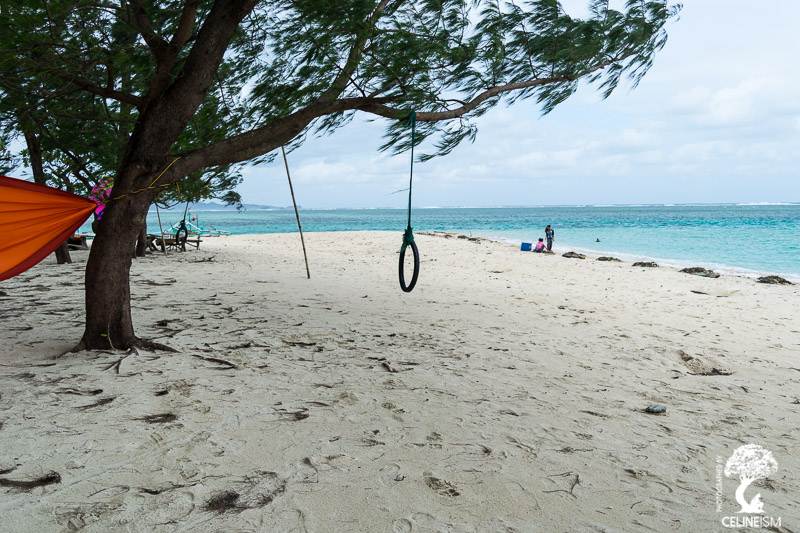
Anguib Beach
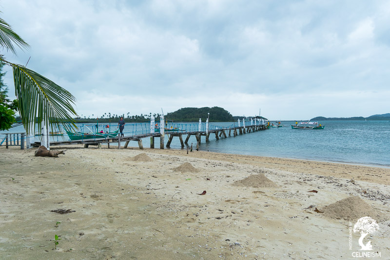
After an hour, a candy-cane shaped strip of land materialized in the horizon. Anguib Beach. The waters relaxed as we neared the tree-lined coast. Jelly legs we might’ve been, but we ran to the sandy shore and thanked heavens for terra firma. We had our breakfast here, under a length of thatched cottage. The steaming macaroni soup was perfect to warm our bones.
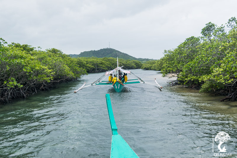
Later, we hopped on our boats for another round of sea-travel. This time, though, we passed through still waters and clumps of mangroves. We glided parallel to the reef where, beyond, the waters turned violent again. Shortly, we docked in another white-sand beach. Punta Verde, it was called, and here we had our seafood fiesta. Prepared by the generous and masterful people behind Jaja Restaurant, our lunch was the bounty of the sea. Heaps of lobsters and shrimps filled the tables. There were fish, seaweed, and adobo too. Judging from the plates of my companions, the arduous journey did nothing to spoil their appetites.
Still massaging our stuffed bellies, we were warned of the dangers of proceeding to our next destination. Fortunately, the honorable coast guards guaranteed it was fine. And it wasn’t like we were going to let the matter rest just like that. We wanted Palaui so bad, the Universe was rearranging its stars to make it happen.
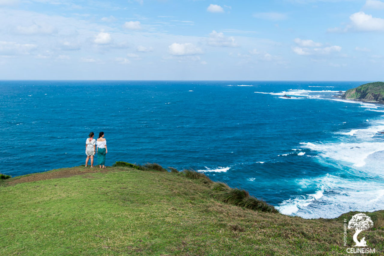
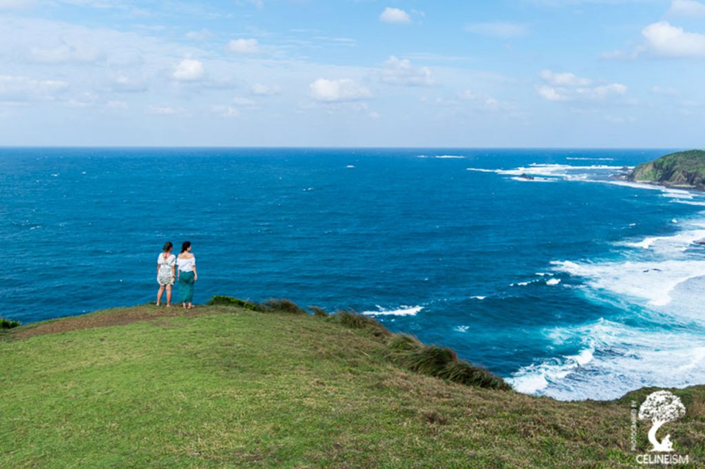
Palaui Island
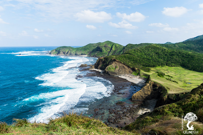
Palaui Island lies on the northeastern tip of the Cagayan Valley. It’s one of those handful of places that are hailed as a next-best-thing-to-Batanes. With its stretch of radioactive green fields and dramatic drops, Palaui does come pretty close.
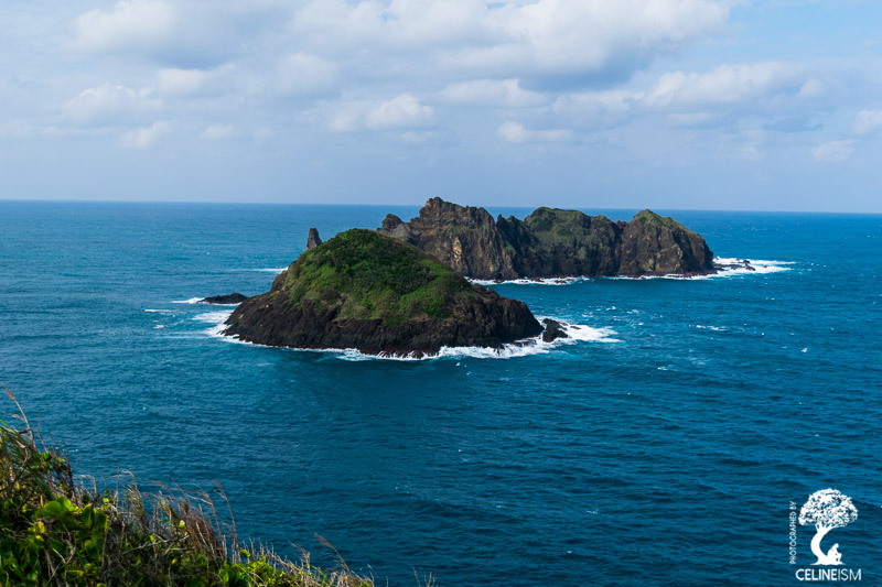
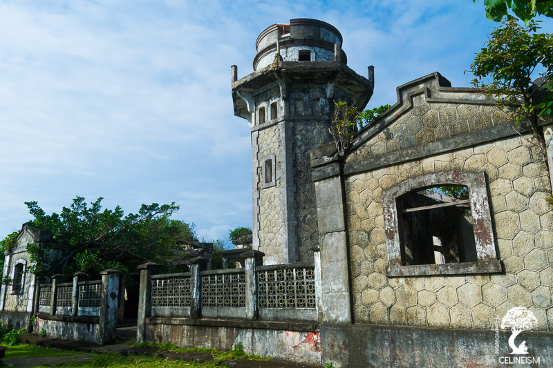
That Friday in early March, we went to a short trek up Cape Engaño. After a going through a path that affords an incredible panorama of the island, a stone structure came into our view as we reached the top. It was a lighthouse. Built during the Spanish Colonial period, Faro de Cabo Engaño towers over the limitlessness of the Pacific Ocean. To its north, the islands of Babuyan and Dos Hermanas can be seen. Suffice it to say, the view from here is simply breathtaking.
Cape Engaño was a most fitting Swan Song to Lakbay Norte 6. On the rim of this blessed island, the ocean extending away, the world seemed to tell us, “There’s more”. And after six days of discovering the treasures of the North, there is, indeed, so much more to uncover.
Essential Information
How to Get There
From Manila, Victory Liner buses have daily trips going to Tuguegarao City in Cagayan (12 to 14 hours). Once in Tuguegarao, there are buses and vans that will take you to the Sta. Ana Commercial Center where you can stock up on supplies. Then, take either a tricycle or a quadcycle to San Vicente Port – the jump-off to Palaui Island.
To tour you around the many islands and coves in the area, get in touch with the SAMOBA (Sta. Ana Motorize Boat Association). Details below.
Contact Details
Anguib Beach Club (Glamping and Overnight Services at Anguib Beach)
+63 917 652 0581
[email protected]
Facebook.com/staanaglampingandcampingresorts
Sta. Ana Motorize Boat Association
+63 935 383 9878 / +63 926 188 0213 / +63 935 130 6745
For bus schedules visit www.victoryliner.com
My name is Celine, forever 18, thrill-seeker, tree-hugger, moon-worshipper, tea-chugger, and storyteller extraordinaire!